Walking routes
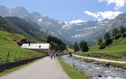
In Lourdes and surroundings there are numerous signposted routes for both the experienced and the occasional walker. A tranquil walk through nature or a brisk mountain hike to the top of a mountain or to the coolness of a Pyrenean lake. The possibilities are endless.
More routes on:
SITE.TERUGWalking in the forest or along the lake of Lourdes
Put on your walking shoes and go discover Lourdes!
Discover the forest ‘bois de Lourdes’, where Bernadette gathered wood at the time of the apparitions. The forest of Lourdes consists of approximately 450 hectares and offers many hiking trails, sportive trails, play areas for children and places to have a picnic.
In addition to the forest, there is also a lake at Lourdes: the Lac de Lourdes, along which it is wonderful to stay! Alternate the walk with a pedal boat ride on the lake!
La Voie Verte des Gaves from Lourdes to Cauterets
On foot or by bicycle: discover one of the most beautiful valleys of the Pyrenees at your own pace. La Voie Verte des Gaves is a 19,6 km long route between Lourdes and Cauterets, a mountain village in the heart of the Hautes-Pyrénées. Discover the many mountain peaks, the banks of the Gave de Pau, the medieval tower, the nature reserve, and so much more along your way!
More information and map:
Pont d'Espagne and Lac de Gaube in Cauterets
Pont d’Espagne is located in the middle of the ‘Parc National des Pyrénées’. Although the name suggests otherwise, this is not the border with Spain, but a piece of protected nature where you can immerse yourself in the beauty of the Pyrenees and admire the most beautiful waterfalls! It is the starting point of a mountain hike with breath-taking views of the Lac de Gaube mountain lake. For those who do not like hiking routes so much, it is also the starting point of the cable-car that guarantees a maximum view with much less effort.
Pont d’Espagne is approximately 40 km from La Paloumère holiday home. The site is easy to reach by car or by bus and offers plenty of parking space. From the car park, it is only a few minutes' walk to Pont d’Espagne (1496 m), from where you have a beautiful view of a breath-taking waterfall.
It is then an hour’s walk From Pont d’Espagne to the beautiful mountain lake ‘Lac de Gaube’ (1725 m). Turn left just before the bridge and follow the GR10. The path is surrounded by spruce and pine trees and starts as a little pathway paved with large cobblestones. It soon converges into a rocky slope. You can shorten the hike considerably by taking the cable car to the Belvédère du Télésiège at Pont d'Espagne, from where it is only a 15 min walk on flat ground to Lac de Gaube.
More info:
RouteYou Lac de Gaube - Refuge des Oulettes
Cirque de Gavarnie
Gavarnie is best known for the former glacier basin, the Cirque de Gavarnie. You already have a nice impression of this wonderful natural phenomenon down in the valley. The steep glacier walls of the Cirque de Gavarnie also form the border with Spain. There are several large waterfalls along these walls. The largest one is called the ‘Grande Cascade’.
The town of Gavarnie is situated approximately 50 km from the holiday home La Paloumère. After you have parked your car, follow the road signs via Chemin du Cirque. The road is basically self-indicative and continues more or less straight on, right up to the big waterfall. The latter is actually already visible from the village. You will pass souvenir shops and a rental post where you can rent a horse or (mule) donkey for a ride. The first kilometre of the path is quite flat, then it becomes steeper and uneven. The trip from the village to the little café is approximately 3km. From there, you can go to the point where the high waterfall hits the ground. However, this path could be a bit treacherous.
More info:
 +32 494 313 606


